
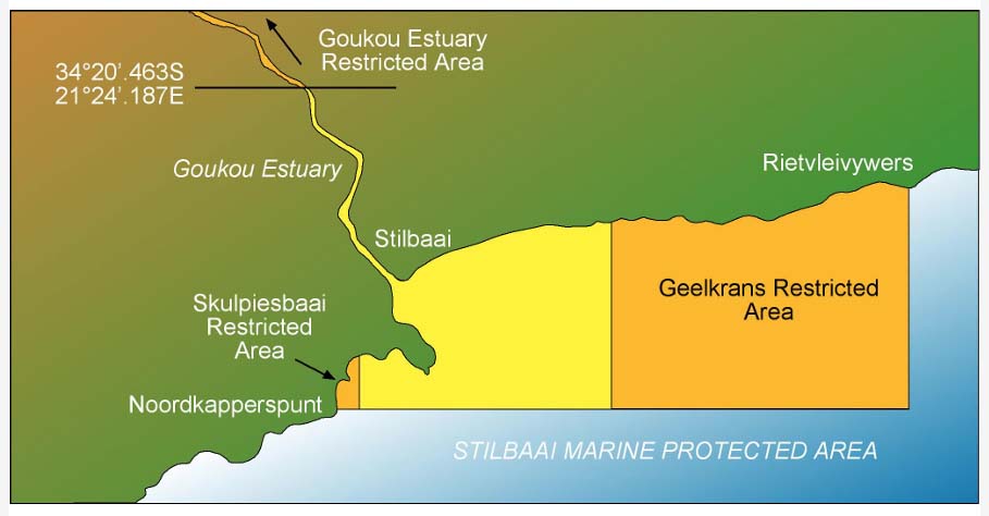
BOUNDARIES
The MPA is between Noordkapperspunt and Rietvleivywers, and includes the estuary of the Goukou River for 15 km (9.3 mi) upstream. The seaward boundaries are from S34°23.964′, E021°24.800′ at Noordkapperspunt to S34°23.964′, E021°30.976′ to S34°21.676′, E021°30.976′ at Rietvleivywers. The shoreline boundary follows the high-water mark from Noordkapperspunt through the harbour, along the western shore of the estuary to 34°17.830′ 021°18.620, and back along the eastern shore to the mouth and from there to Rietvleivywers.
Management-Plan-Stilbaai-MPA-20092