
BOUNDARIES
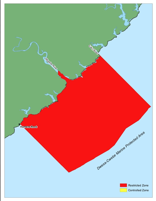
The revised boundaries as proclaimed in 2015 are:
- Inshore boundary is the high-water mark between Human’s Rock at S32°18.934′, E28°49.549′ and the Ntlonyane River mouth at S32°11.884′,E28°57.435′
- Offshore south-eastern boundary is about twelve nautical miles seawards of the high-water mark between S32°28.049′, E28°58.685′ and S32°20.831′, E29°06.770′
- South-western boundary: A line at 135° from Human’s Rock S32°18.934′, E28°49.549′ to S32°28.049′, E28°58.685′
- North-eastern boundary, a line drawn 135° from the Ntlonyane River mouth. S32°11.884′, E28°57.435′ to S32°20.831′, E29°06.770′
- All tidal estuaries between Human’s Rock and Ntlonyane River mouth are included as far upstream as the 5 m depth contour extends.